What Is a Site Plan for a Building Permit?
By Koray Bozkurt, PE, PMP, BOZ Engineering Group. Last updated June 2026.
You’ve drawn up plans for a new deck, a garage, or a home addition, and you’re ready to file for a permit. Then the county sends you back a checklist, and near the top sits a line item that stops you cold: “site plan required.” If you’re a DMV homeowner or builder, that request is one of the most common reasons a permit application stalls before review even begins. A site plan sounds simple, but it carries specific requirements that vary across DC, Maryland, and Virginia.
So what exactly is a site plan, what does it have to show, and who’s qualified to draw one? This guide walks through the definition, the required elements, when permit offices demand one, how a site plan differs from a plot plan and a survey, and what you should expect to pay. We’ll keep it grounded in how permitting actually works across the District, Maryland, and Northern Virginia.
Key Takeaways
- A site plan is a scaled, overhead drawing that shows your property lines, setbacks, easements, utilities, and every existing and proposed structure on the lot.
- In DC, the building plat must show all existing and proposed structures on the property and be certified by the DC Office of the Surveyor (DC Department of Buildings).
- In Fairfax County, plats must be signed and sealed by a licensed professional under Virginia Administrative Code 18VAC10-20-380 (Fairfax County).
- Non-certified drafting typically runs $89 to $259, while a certified, stamped plan from an engineer or surveyor usually starts around $500 (Get A Site Plan).
What is a site plan for a building permit?
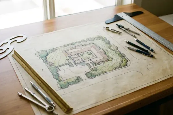
A site plan is a scaled, birds-eye drawing of your entire property that shows where structures sit in relation to your property lines, setbacks, and other features. Permit reviewers use it to confirm your project complies with local zoning. Most jurisdictions require core elements such as boundaries, building locations, setback dimensions, easements, and utility lines (Site Plan Creator, 2025).
Think of it as the zoning half of your permit package. Your construction drawings prove the structure is built safely. Your site plan proves the structure is allowed to exist where you want to put it. A reviewer scans it to answer one question fast: does this project fit within the rules for this lot? If the drawing can’t answer that clearly, your application waits.
What must a site plan include?
A site plan must show property lines and lot dimensions, existing and proposed structures, setback distances to each boundary, easements, utilities, driveways, and lot coverage, all drawn to scale with a north arrow. Site plans are frequently rejected for missing setback dimensions, unverified boundaries, or failure to identify easements and utilities (Site Plan Creator, 2025).
That last point matters. A single missing dimension can trigger a resubmittal and add weeks to your timeline. Here’s what a permit-ready residential site plan should contain.
| Element | What it shows | Why the reviewer needs it |
|---|---|---|
| Property lines & dimensions | The legal boundary of your lot | Confirms you’re building on your own land |
| Setbacks | Distance from structures to each property line | Proves zoning compliance |
| Existing structures | House, garage, sheds already on the lot | Establishes the current baseline |
| Proposed structures | The deck, addition, or building you’re adding | Defines the scope under review |
| Easements | Areas where others have access rights | Prevents building over utility or access corridors |
| Utilities | Water, sewer, gas, electric lines; well and septic if applicable | Avoids conflicts with service lines |
| Driveways & parking | Access points and paved surfaces | Checks impervious surface and access rules |
| Lot coverage | Percentage of the lot covered by structures | Confirms you’re under the zoning maximum |
| North arrow & scale | Orientation and measurement reference | Lets the reviewer verify distances |
When do permit offices require a site plan?
Permit offices require a site plan whenever a project changes the footprint or exterior of a structure. In DC, you must include a building plat when you apply for a permit to do exterior work on your property, such as building an addition or adding a deck (DC Department of Buildings, 2025). Whether interior-only work triggers a plat can vary, so confirm with your local jurisdiction.
The pattern holds across the DMV. Interior work that doesn’t touch the building envelope usually skips the site plan. Anything that adds, expands, or relocates a structure triggers it. A new deck, a detached garage, a home addition, an accessory dwelling unit, a pool, or a large shed will all put “site plan” or “plat” on your checklist. In Fairfax County, an accurate survey is required anytime a structure is altered, to determine whether the project meets building, site, and zoning requirements (Fairfax County, 2025).
One practical tip before you order anything: call your local permit office and ask whether they need a certified plan or accept a non-certified drafting. That single phone call can save you several hundred dollars. If you’re mapping out a broader project, our guides on building permits in DC, MD, and VA and what a grading plan is cover the neighboring documents you may also need.
Who prepares a site plan?
Site plans are prepared by licensed civil engineers, land surveyors, or in some cases architects, depending on the complexity and whether certification is required. In Fairfax County, plats must be signed and sealed by a licensed professional in accordance with Virginia Administrative Code 18VAC10-20-380 (Fairfax County, 2025).
For a simple project, a homeowner can sometimes draw a basic non-certified plan themselves using an existing survey as the base. But once your permit office asks for a stamped or certified document, you need a licensed professional. A land surveyor establishes exact property boundaries. A civil engineer handles grading, drainage, utilities, and lot coverage calculations that show your project fits within zoning limits. For most additions, garages, and pools in the DMV, that engineering review is where the value sits.
How does a site plan differ from a plot plan and a survey?
A site plan, a plot plan, and a survey overlap but serve different purposes. A survey establishes legal boundaries. A plot plan is a simpler drawing of structures on a lot. A site plan is the most detailed, adding utilities, grading, easements, and lot coverage. In DC, the required plat must be certified by the DC Surveyor (DC Department of Buildings, 2025).
People use these terms loosely, and permit offices sometimes use their own vocabulary. In the District, the required document is called a “plat.” In Virginia, you’ll often hear “house location plat” or “house location survey.” Whatever the label, the reviewer wants the same thing: proof that your structures and boundaries are where you say they are. Here’s how the three documents compare.
| Document | Primary purpose | Prepared by | Typical detail level |
|---|---|---|---|
| Survey | Establish legal property boundaries | Licensed land surveyor | Boundaries, corners, monuments |
| Plot plan | Show structures on the lot | Surveyor, engineer, or homeowner | Buildings, setbacks, basic dimensions |
| Site plan | Full zoning and engineering compliance | Civil engineer or surveyor | All of the above plus utilities, grading, easements, lot coverage |
Which one do you need? That depends entirely on what your permit office asks for, which is why that pre-order phone call is worth making.
How much does a site plan cost in the DMV?
Costs depend on whether you need a certified plan. Non-certified drafting typically runs $89 to $259 and works for many residential permits, while a certified, stamped plan from a licensed engineer or surveyor generally starts around $500 and can exceed $1,000 for complex work (Get A Site Plan, 2025).
In practice, most DMV homeowners doing an addition, garage, or pool land in the certified category because the permit office wants a stamped document. The price climbs with lot complexity, whether an existing survey is available, and how much grading and drainage analysis the project requires. A flat lot with a clean recent survey costs far less to plan than a sloped lot with easements and stormwater concerns. Certified plans are required when the office explicitly requests a stamped document, when new construction involves structural review, or when local rules demand survey-grade accuracy (Get A Site Plan, 2025).
Cost planning your whole project? Our home addition cost guide and deck permit guide for the DMV break down the other line items you’ll want to budget for.
What happens if your site plan is wrong or incomplete?
An incomplete site plan gets your application returned before technical review, adding days or weeks to your timeline. Reviewers commonly reject plans for missing setback dimensions, incorrect zoning classifications, or unidentified easements (Site Plan Creator, 2025).
Quality of the drawing itself matters too. Fairfax County notes that surveys photographed, scanned by phone app, faxed, or otherwise altered may not be accepted if they lack resolution and detail (Fairfax County, 2025). The proposed work must be drawn onto the plat to scale, not sketched by hand over a blurry copy. Getting it right the first time is almost always cheaper than a rejection and resubmittal cycle.
Ready to move your permit forward with a plan that clears review the first time? Request a site plan from our licensed team.
Frequently Asked Questions
Do I need a site plan for interior renovations?
Usually not. In DC, a building plat is required when you apply for a permit to do exterior work such as an addition or a deck (DC Department of Buildings, 2025), and site plans are generally triggered by exterior and footprint changes rather than interior finishes. Because interior-only projects like a bathroom remodel are handled differently by each office, confirm with your local jurisdiction.
Can I draw my own site plan?
Sometimes, for simple non-certified plans. But most permit offices require a stamped document from a licensed professional for additions and new structures. In Fairfax County, plats must be signed and sealed by a licensed professional under Virginia Administrative Code 18VAC10-20-380 (Fairfax County, 2025), which a homeowner cannot provide.
How long does a site plan take to prepare?
For a straightforward residential project with an existing survey, a certified site plan often takes a few business days to a couple of weeks. Complexity drives the timeline. Lots with grading, drainage, or easement issues take longer because they require the additional engineering analysis that permit reviewers check against zoning limits (Site Plan Creator, 2025).
What’s the difference between a plat and a site plan in DC?
In the District, “plat” is the term DOB uses for the required document. It must show all existing and proposed property improvements and be certified by the DC Office of the Surveyor (DC Department of Buildings, 2025). Functionally it serves the same zoning-compliance role a site plan does in Maryland and Virginia.
Will I need any other plans besides a site plan?
Often yes. Depending on your project and jurisdiction, you may also need a grading plan showing drainage and disturbed-area limits. Fairfax County requires disturbed area limits and flood plain features to be shown when applicable (Fairfax County, 2025). Our grading plan guide explains when that separate document applies.
Koray Bozkurt, PE, PMP, is the founder and principal engineer of BOZ Engineering Group, a full-service firm licensed in DC, Maryland, Virginia, and Florida. He holds a master’s degree in geotechnical engineering and brings more than 18 years of structural design experience to residential and commercial projects across the DMV.